Schnalstal snow report
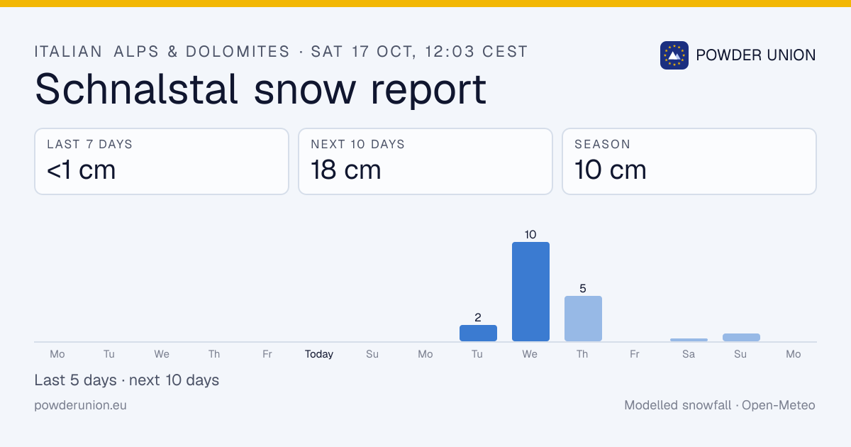
Schnalstal has picked up <1 cm in the last 7 days and 10 cm this season. 18 cm is forecast over the next 10 days.
Data: Open-Meteo (modelled) at the upper mountain, ~3,200 m · forecast every 6 h, season totals daily · Updated Sat 17 Oct, 12:03 CEST
Schnalstal snowfall: last 24 hours, last 7 days, season
When to go: Schnalstal this week
No powder day this week. Next flakes Tue 20 Oct, 2 cm.
Daily snowfall, midnight to midnight local time (Europe/Rome). Past days are model analyses; days 6–10 are drawn lighter because forecasts that far out change a lot.
How does this season compare?
Schnalstal ranks #5 of 110 Italian Alps & Dolomites resorts by season total (10 cm). Biggest single day in the last 10 days: 1 cm on Thursday 8 Oct.
A typical season brings about 581 cm to the upper mountain (2017–18 to 2025–26, modelled). Season-by-season snow history
10-day snowfall history
| Date | Snowfall | High / low |
|---|---|---|
| Today (so far) | 0 cm | 5° / −2° |
| Fri 16 Oct | 0 cm | 9° / 2° |
| Thu 15 Oct | 0 cm | 6° / 2° |
| Wed 14 Oct | 0 cm | 5° / −1° |
| Tue 13 Oct | 0 cm | 2° / −3° |
| Mon 12 Oct | 0 cm | 0° / −6° |
| Sun 11 Oct | 0 cm | 2° / −5° |
| Sat 10 Oct | <1 cm | 0° / −4° |
| Fri 9 Oct | 0 cm | 2° / −3° |
| Thu 8 Oct | 1 cm | 1° / −3° |
Schnalstal snow forecast: next 7 days
| Day | Weather | Snow | High / low |
|---|---|---|---|
| Today | 0 cm | 5° / −2° | |
| Sun 18 Oct | 0 cm | 1° / −4° | |
| Mon 19 Oct | 0 cm | 5° / −2° | |
| Tue 20 Oct | 2 cm | 1° / −2° | |
| Wed 21 Oct | 10 cm | 0° / −3° | |
| Thu 22 Oct | 5 cm | −3° / −8° | |
| Fri 23 Oct | 0 cm | −3° / −9° | |
| Total | 17 cm |
Modelled by Open-Meteo at the upper mountain; 10-day total 18 cm.
Resort facts
- Elevation
- 2,005 m – 3,200 m
- Pistes
- 33 km
- Lifts
- 11
- Location
- Bolzano/Bozen, Italy
Where does this data come from?
Recent and forecast snowfall at Schnalstal is modelled by Open-Meteo from the best available national weather models and ECMWF, at the resort's grid point and downscaled to the upper mountain (3,200 m).
Season-to-date totals are rebuilt daily from the ECMWF IFS archive and compared with the same model's 9 seasons from 2017–18 to 2025–26, so "% of normal" compares like with like.
Models smooth out terrain, so treat the numbers as a guide and cross-check the resort's own report. Never use them for avalanche decisions: read the AINEVA bulletins.
Nearby resorts
Italian Alps & Dolomites snow report · All Italy resorts · Shareable snow image
Common questions
How much snow has Schnalstal had this season?
10 cm since 1 October. Updated Sat 17 Oct, 12:03 CEST.
How much snow fell at Schnalstal in the last 7 days?
<1 cm in the past week; 0 cm in the last 24 hours.
Is snow forecast at Schnalstal?
17 cm in the next 7 days and 18 cm over 10 days (modelled at the upper mountain).
Where does the Schnalstal snow data come from?
Snowfall is modelled by Open-Meteo at 3,200 m from national weather models and ECMWF.
Which ski areas are near Schnalstal?
Nearby: Kaunertaler Gletscher, Pitztaler Gletscher, Nauders Bergkastel, Schöneben - Belpiano.